#TBT Throwback Thursday’s Feature is Recommended Readings: Professional and Practical Considerations for Landscape Design, Steven L. Cantor
By Linda S. Velazquez, Originally Posted on Greenroofs.com on May 6, 2020
Publisher’s Notes: Will you be in San Francisco at the ASLA Convention on Landscape Architecture 2022? If so, join Steven L. Cantor for his Book Signing on Sunday, November 13 from noon to 1:30 in the Expo Hall! If you’re not registered, you may attend the book signing by requesting an escort at one of the ASLA Registration desks at Moscone Center.
See ASLA’s Book Review now in the current November 2022 issue of Landscape Architecture Magazine on page 178.
Updated Pricing: Hardcover: $122; Paperback: $45.55; and eTextbook: $40.99* One reason the paperback book was printed in the small size format of 6” x 9” was to hold down the price and make it affordable to students and young professionals.
Accomplished educator, author, and registered landscape architect Steven L. Cantor, ASLA has contributed here on Greenroofs.com since 2013 as the Landscape Editor. His critical and experienced eye has produced the excellent 14-part series from 2013-2015 “A Comparison of the Three Phases of the High Line, New York City: A Landscape Architect and Photographer’s Perspective” as well as other features (see: Copenhagen Green Tour 2015).
I’m very pleased to review his latest book, an in-depth dive into the workings of landscape design.
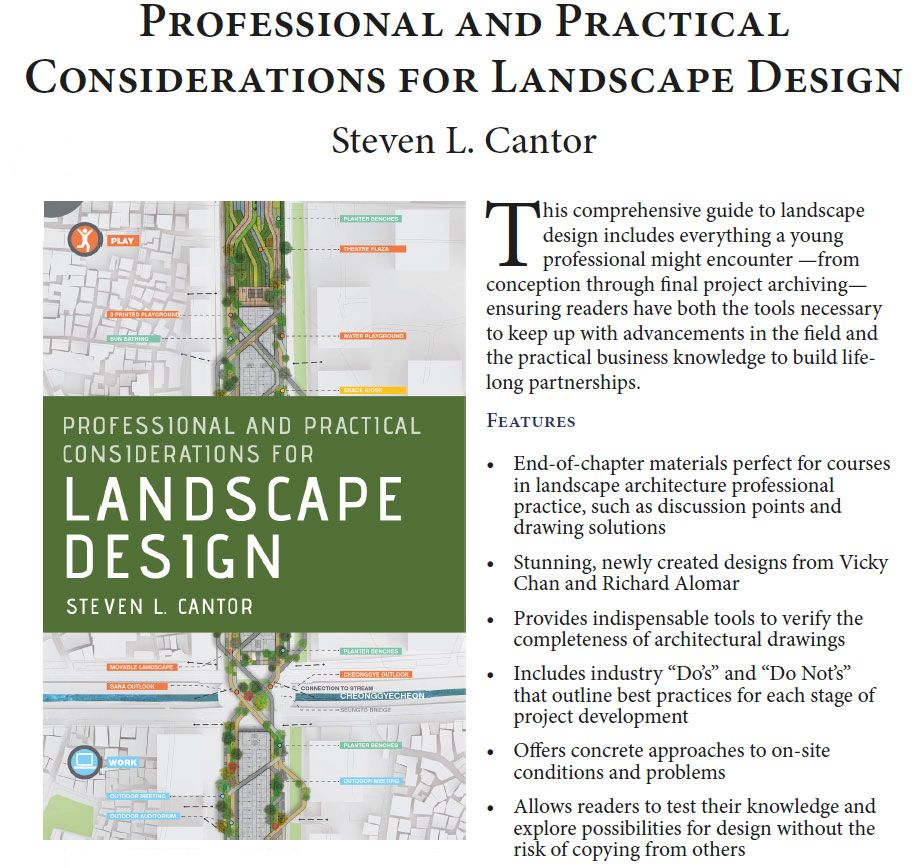
Published in January by Oxford University Press (OUP), Steven L. Cantor’s Professional and Practical Considerations for Landscape Design is simply an overall asset for those of us in the landscape architecture and design field, yet it is not simple at all. As its title promises, the author delves into all aspects of the practice of landscape architecture:
“The professional practice of landscape architecture consists of the methods, approaches, and documents that landscape architects use and prepare in order to apply for and find work; to hire staff with appropriate salary, training, and benefits; to sustain a project while it progresses through the design and construction stages; to carry out such projects at a profit; and to archive projects when they are finished.” ~ Steven L. Cantor
Steven’s fourth book of landscape architecture, the 491-page Landscape Design uniquely serves as a comprehensive resource and practical handbook for university teaching professionals as well as advanced students of landscape architecture. His publication eloquently addresses myriad facets of design and business accompanied by approximately 130 detailed illustrations (25 in color), provided by professional colleagues Vicky Chan and Richard Alomar along with original photos from others, including many of his own.
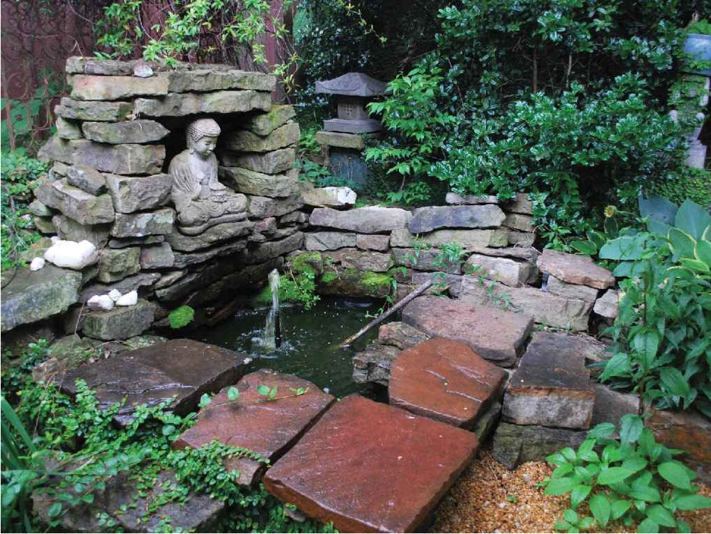
Figure 1.0 An intimate garden with a recirculating water feature in Little Rock, Arkansas. Design by Gary Evans and William Gabello. Photo by Steven L. Cantor.
Design and Thought Provoking
In Landscape Design‘s Preface, Steven points out that while there may be frequent opportunities to try again to get things right in many professions, nature may not always be that forgiving if a landscape design goes awry. Thus, he presents the reason for his book as a question:
“How do you document the process and give yourself and your firm the best chance to get things right?” ~ Steven L. Cantor
As always, Steven’s current work is thoughtful, detailed, and design provoking – perhaps one of its most important features. In addition to providing specific guidelines and methods, he encourages the reader to always explore and assess each landscape design situation individually and consider various alternatives to create a positive outcome from different aspects.
At the end of each section and chapter, problem statements and other exercises are offered as well as a very practical series of Dos and Don’ts. I found these topics with varying degrees of difficulty particularly useful.
The book’s different formats and styles engage the reader, and just some of Landscape Design‘s additional features include:
*Encompassing four years of work, OUP printed Professional and Practical Considerations for Landscape Design in a 6.25″ x 9.25″ format in order to offer an affordable price for students and young professionals. The hardcover and paperback are available on Amazon (which is currently less expensive than from their own press). And this great offering is also available as an extremely affordable eTextbook which may be a great way to go for students, in particular for teaching professionals to incorporate it into their curriculum. Updated Pricing: Hardcover: $122; Paperback: $45.55; and eTextbook: $40.99
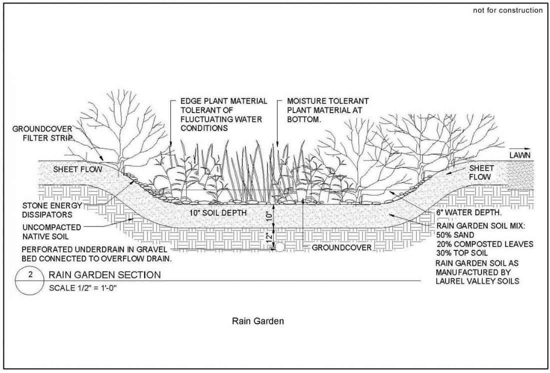
Figures 2.7a and 2.7b Example of something worth inventing as a unique deign element, in this case a rain garden at the Floriculture Greenhouse Outdoor Living Lab at Rutgers University, New Brunswick, New Jersey. Neil J. Weket and Richard Alomar.
Discussions of Professional and Practical Considerations
Each chapter contains important and specific information pertinent to the subject including project management and office administration; contracts; marketing and human resources; different types of drawings; building codes, specifications and cost estimates; diverse areas of practice; construction materials, details and site inspections; sustainability and ethics, and finally, resources.
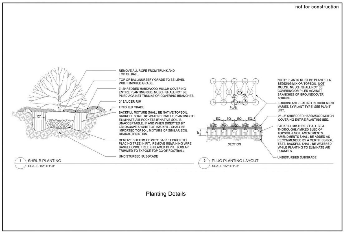
As a potential course book, there are sections having some good, practical applications for classes or studios in site planning, single family residential design, planting design, public works, environmental assessment, international design, roof gardens and greenroofs, and construction detailing.
Here’s what noted landscape architect and architect Susannah Drake says about Landscape Design on its back cover:
Steven told me that his main purpose for writing Landscape Design is to generate discussion which, in my opinion, it is uniquely presented to do so.
Overall,Landscape Design is perfect as a study guide for the landscape architecture registration exam, and especially for those planning to establish their own firms for good, common sense practices.
I highly recommend the instructional Professional and Practical Considerations for Landscape Design for students, emerging professionals, and those of us already working within the field as the fully comprehensive go-to resource and convenient guidebook for successful practice. I will definitely keep this superb handbook close.
Author Information
Steven L. Cantor, RLA, ASLA, has worked in private practice for firms in New York City and Atlanta. He taught at the University of Georgia School of Environmental Design in Athens, the University of Colorado in Boulder, the New York Botanical Garden, and Anhalt University in Bernburg, Germany. He has written about landscape architecture for over thirty years in books, journals, magazines, and websites.
Vicky Chan, architect, founded Avoid Obvious Architects in 2012, a firm focused on combining art with green technology. His projects have been exhibited in 37 cities and have won 38 design awards. Starting in 2020, Chan is President of the American Institute of Architects Hong Kong Chapter.
Richard Alomar, RLA, is the Associate Director of the Office of Urban Extension and Engagement and an Associate Professor in the Department of Landscape Architecture at Rutgers University, New Brunswick, NJ.
Landscape architects are working with the U.S. Army Corps of Engineers and building new networks through the Engineering With Nature program. The implications could be transformative for both.
By Jared Brey
Monica Chasten (foreground) and Sean Burkholder (center, holding a coffee) survey the opportunities with the team near Matts Landing in New Jersey. Courtesy Jared Brey.
A needle that falls in the southern reaches of the New Jersey Pinelands might find itself washed into the Maurice River and carried by its current to Delaware Bay. The Maurice flows south in tight coils, and before it reaches the estuary, it’s forced into one final wide bend around a long dike at Matts Landing, near the old bayside oyster towns of Bivalve and Shell Pile.
Gathered at the base of the dike one morning last spring was a group of engineers and researchers, milling about under a cloud-swept sky as they waited for Monica Chasten, a project manager for the U.S. Army Corps of Engineers Philadelphia District, who is overseeing the first dredging of the Maurice River in 20 years. They were also joined by Sean Burkholder, an assistant professor of landscape architecture at the University of Pennsylvania Stuart Weitzman School of Design and a member of the Dredge Research Collaborative, a loose affiliation of landscape architects who have been studying the movement and reuse of sediment since 2010.
The tide was out. Mudflats stretched out into the salty water on the bay side of the dike. Sanderlings and willets scampered and flocked. Slowly, the group walked out onto the dike, and began talking about how the mud from the bottom of the Maurice River might be used to create new marshland at its mouth. Could the dredging tube be laid across the dike to transfer sediment from one side to the other, or would that put the dike at risk of collapse?
Modeling of the Maurice River, which hasn’t been dredged in 20 years. Courtesy University of Pennsylvania/Environmental Modeling Lab.
“You could think about putting the dredge pipe, at least for a period of time, up on the marsh and letting [sediment] flow down into it,” Chasten said. “Which is kind of the Engineering With Nature approach, to let the landscape do the work.”
“Yeah,” Burkholder said. “It’s just a matter of making sure we have a baffle or something up there so we’re not blowing the marsh out while we’re placing.”
They talked this way for an hour, making their way down the dike. Should a Y-valve or a spreader be used for multidirectional distribution? They’d have to wait until after the horseshoe crab nesting season to do any major placement. And how would they manage people’s expectations about the future of the place? Dumping thousands of cubic feet of sediment into the mudflats would be sure to kill most of the existing vegetation before anything that looked like new, healthy land could be seen emerging.
By way of refocusing, Chasten proclaimed, “The primary mission of this project is to clear the channel.”
The group, including members of the Dredge Research Collaborative, works with the corps’s regional districts, including Baltimore, to extend the value and function of nature-based solutions. Courtesy Dredge Research Collaborative.
Over the past decade, the U.S. Army Corps of Engineers has begun purposefully incorporating natural processes and nature-based features into some of its flood-control and navigation projects through a program called Engineering With Nature (EWN). The corps, deeply committed to acronyms and bureaucratese, describes the program as “the intentional alignment of natural and engineering processes to efficiently and sustainably deliver economic, environmental, and social benefits through collaboration.”
Engineering With Nature is staffed by a small group of employees who act almost as internal consultants to the corps’s regional districts, which are tasked with actually carrying out infrastructure projects. It has published two atlases highlighting engineering projects in the United States and around the world that embody the EWN principles. But it’s still too early to know the program’s long-term impact, both on the corps and on coastal and flood-control infrastructure.
Landscape architects are playing a growing role in that negotiation. In 2017, the corps’s Engineer Research and Development Center (ERDC) and the Dredge Research Collaborative hosted a workshop at ERDC’s base in Vicksburg, Mississippi, to explore ways that landscape architects and engineers could work together. That workshop has led to a series of formal collaborations, including awarding research grants to a group of academics led by Rob Holmes, ASLA, an associate professor of landscape architecture at Auburn University (and a Dredge Research Collaborative member), along with Burkholder at Penn; Justine Holzman, formerly an assistant professor of landscape architecture at the University of Toronto, now studying for a PhD at Princeton, and others. Together they have produced a series of Engineering With Nature + Landscape Architecture (EWN + LA) reports, which outline design concepts for various sites of intervention by the corps, including a group of jetties in the Chesapeake Bay, the Comite Canal in Louisiana, and the New Jersey Back Bays that separate the mainland from the barrier islands and resort towns. The group has also published articles in the journal Integrated Environmental Assessment and Management describing their collaborations in recent months.
“What I find very intriguing with landscape architects, and why I value them so much, is that anything is possible,” says Jeffrey King, Affiliate ASLA, the deputy national lead and program manager for Engineering With Nature. “They’re not constrained in the purest sense of engineering, and they can think beyond a biological context.”
The EWN reports have focused on large-scale engineering challenges, like the Sabine Pass to Galveston Bay project on Texas’s Gulf Coast. Courtesy Dredge Research Collaborative.
These collaborations have the potential to alter, however gradually, the way the corps plans its interventions in the landscape and its role in building infrastructure for an age of climate change and environmental fragility. And they have the potential to open new areas and methods of practice for landscape architects.
“Engineering With Nature is trying to help the corps see where the most valuable things it’s doing are and to disseminate that—to shift what the corps is doing as a whole,” Holmes says. “To me, supporting that work is probably the most valuable thing that we’re doing. In the long term, there’s an enormous amount of work that needs to be done for climate adaptation, and what we’re going to need is not just the desire to do that work…we’re going to need the expertise and the networks of practical knowledge about how to build nature-based infrastructure. That’s what we’re contributing to.”
The landscape architects who founded the Dredge Research Collaborative share a fascination with the transformative possibilities of displaced sediment (see “The Dredge Underground,” LAM, August 2014). The corps is the country’s chief displacer of sediment and builder of water infrastructure, and that infrastructure “is one thing that our society has agreed that everyone gets,” says Brian Davis, an associate professor of landscape architecture at the University of Virginia. So working with the corps is a way for landscape architects to design spaces that are typically outside their professional realm and that are threaded throughout the built environment differently than other types of public or private spaces.
Diagrams and renderings of nature-based solutions help communicate the work to the public. Courtesy Dredge Research Collaborative.
“The scale of things they make and the impact on the environment [are] way bigger than park making or other types of landscape making,” Davis says. “That’s attractive to me in terms of its potential for impact and creating common ground and aesthetic values more broadly.”
Engineering With Nature was founded around the same time as the Dredge Research Collaborative. Todd Bridges, a senior research scientist with the corps who helped create the program and still leads it, says it was spurred by a confluence of factors. Among them was what the World Economic Forum estimated was a $100 trillion global need for infrastructure investment over the next several decades, and a desire on the part of corps leadership for innovation.
“When you consider how large the investments are, it begs the question: How could we expand the value from that investment?” Bridges says. “What are the ways we can diversify the value that can be produced through infrastructure investment?”
Sediment has been used to build marsh islands between mainland New Jersey and beach resorts, such as Mordecai Island in Barnegat Bay. Courtesy U.S. Army Corps of Engineers.
The program had an obvious ecological bent—Bridges has cited Ian McHarg’s Design With Natureamong its foundational influences—but it was also justified as a way to make the corps’s work more cost-efficient. The EWN atlases highlight corps projects that have created environmental benefits, such as using dredged sediment to make new wildlife habitat, but those benefits have always been by-products of a broader engineering purpose. The program works by trying to create multiple benefits out of work that’s already going to happen. To gain purchase for EWN principles within the corps, Bridges faithfully speaks the language of “value.”
Some of the most elegant EWN strategies have in fact come from attempts to improve engineering efficiency. At the Horseshoe Bend Island in the Atchafalaya River, the corps placed sediment upstream, in midriver mounds, and allowed it to flow through the river’s current and accrete on the island over the past couple of decades, effectively allowing the island to “self-design.” In the process, it improved habitat for birds, invertebrates, and other organisms. Highlighted in the first EWN atlas, the Horseshoe Bend project actually predates the program. The concept for the sediment placement was created by one maintenance engineer in the corps’s New Orleans District who was just trying to make his job easier, Davis told me.
Similar strategies are being employed in the New Jersey Back Bays, where the Philadelphia District is charged with maintaining the navigability of the Intracoastal Waterway. There, the district is using dredged sand and mud to create and improve islands in the bays that are critical habitat for wading birds. At Gull Island in Cape May County, the district released sediment into open water to create a berm on the island’s edge that has helped protect the island from waves and wakes. Projects like those are conducted as experiments through the Seven Mile Island Innovation Laboratory, a partnership between the corps, the state of New Jersey, and the Wetlands Institute in Stone Harbor, New Jersey, which has consulted with Burkholder and some of his colleagues at Penn on design and monitoring strategies.
Todd Bridges, far left, at a work session. Courtesy U.S. Army Corps of Engineers.
It’s yet to be seen how far the experiments will go. Partly because of the institutional culture of the corps, and partly because of the high-stakes, life-safety implications of its infrastructure work, EWN strategies tend to be negotiated add-ons to dredging projects. At the Maurice River, for example, the Philadelphia District has permission to build new marshland, but a mandate to clear the river channel to seven feet of depth. The role landscape architects can play in those projects is determined on a case-by-case basis.
The Environmental Modeling Lab, a project led by Burkholder and other landscape architecture faculty at Penn, recently received a grant from the corps to monitor the evolution of sediment placements at the Maurice River over several years. But Burkholder’s work with the Philadelphia District to design the sediment placement itself isn’t funded, strictly speaking. In some cases, the corps is just looking to landscape architects to make visual renderings of their design interventions as a means of better communicating its work. But for Burkholder and others, the real goal is to get a seat at the table where the infrastructure itself is designed. It’s taken years of relationship building to gain the small foothold they have now, and their collaborative role is still tenuous.
Burkholder says when working with the corps, “You have to demonstrate value. You’re never going to be in charge, and so you’re constantly fighting for agency in that process. There’s no reason you have to be there. They don’t need you. You’re always pushing that brick across the carpet: All the movement that happens is from your own hard work.”
A view across the New Jersey wetlands indicates where new dredge material could be placed. Courtesy Dredge Research Collaborative.
Few people were more familiar with this dynamic, or worked harder to push the corps forward, than Heather Morgan, a landscape architect who died last year at the age of 44. At the time of her death, Morgan was the director of climate risk adaptation at AECOM. But prior to that, she had spent several years leading sustainability programs at the corps. Todd Bridges, who worked with Morgan, says it was her charge to develop a “comprehensive sustainability posture” within the organization, and she built a network of colleagues within the corps to help do it.
In October 2021, Morgan gave a presentation at the Courageous by Design symposium presented by the Cultural Landscape Foundation (TCLF). Her presentation was part of a panel on “Preparing and Adapting Bureaucracies for Our Future Climate.” She spoke at the time about the ways the corps has been constrained by politics, funding, and traditional approaches to engineering and environmental management.
“The Corps of Engineers has been asked for a very long time to put static measures on dynamic systems—not sustainable,” she said. “The corps has also been asked to put single measures on comprehensive systemic problems.”
To combat that paradigm, Morgan called on designers to build relationships with federal agencies like the corps and establish “advocate teams” of like-minded people within those agencies to push forward nature-based solutions. In correspondence with Charles Birnbaum, FASLA, TCLF’s president, Morgan once wrote that she was “trying to change the cultural identity of an agency, inch by inch” by focusing on transdisciplinary collaboration, bringing together landscape architecture with engineering, archaeology, geomorphology, biology, and ecology. A “collective response to climate change” demanded nothing short of that approach, she said.
A marsh augmentation plan for Barnegat Bay. Courtesy Dredge Research Collaborative.
Bridges says that he once woke up to a text message from Morgan the morning after she’d been through an eight-hour medical operation. She was sharing some thoughts about dam removal.
“She was full of ideas,” Bridges says. “She had a very creative intellect—probing and challenging and trying to move herself and her team and the organization forward. She got it that one of the ways we can increase the value through infrastructure investment is to bring more connection between infrastructure and people, which is at the heart of landscape architecture.”
The work continues.
At Matts Landing, as the group sorted through technical questions of sediment placement and management, Burkholder gradually nudged Chasten and the rest of the crew to the end of the dike, where a grove of red cedar trees was growing on a massive pile of oyster shells.
“Let’s go down into this grove of trees. It’s the coolest place here,” he said. “It’ll cheer us up.”
Human-made islands built with sediment could provide habitat and flood management as sea levels rise. Courtesy Seven Mile Island Innovation Lab.
The Wetlands Institute was founded in 1969 when a businessman named Herbert Mills, who was then the executive director of the World Wildlife Fund, bought 6,000 acres of salt marsh with the intention of protecting it from development. Today it incorporates more than 15,000 acres of marsh in the bay behind Seven Mile Island, the barrier beach that’s home to Avalon and Stone Harbor, New Jersey. One morning in May, while I was waiting for a meeting with Chasten and Lenore Tedesco, the institute’s executive director, I walked down a sandy trail onto the boardwalks that hover above the mud. There were red-winged blackbirds screaming in the cedar trees, ospreys nesting on human-made stands, and a lone clapper rail stalking through the mud beneath the boardwalk. At the end of the boardwalk, I looked through my binoculars across the expanse of salt flats and noticed that, in fact, birds were swarming above the water by the hundreds—swallows, terns, ibises, egrets—as numerous as mosquitoes.
In a conference room upstairs, lined with decades-old volumes on marsh wildlife, Tedesco pointed a telescope at Great Flats, an island created with dredged sand to benefit beach-nesting birds, and one of the only elevated spots in the surrounding marshland. More than a quarter of the nesting wading birds in the state of New Jersey are found on Gull and Sturgeon Islands, two marshland sites built up with fill dredged by the corps, she says.
Tedesco has often described sediment—the nutrient-rich, larvae-filled mud at the bottom of the marsh—as the “currency” of wetland ecosystems.
“And Monica is the broker of sediment,” she told me.
Sea-level rise and subsidence are threatening to drown many parts of New Jersey’s ecologically rich marshlands. Courtesy University of Pennsylvania/Environmental Modeling Lab.
Chasten is the EWN lead for the corps’s Philadelphia District, which is considered a “proving ground” for the program. That means the district can use some of its projects to test innovative sediment-placement methods, with the goal of producing multiple benefits. By bringing together the corps and the Wetlands Institute, along with permitting agencies and others, the Innovation Lab can link ecosystem needs with opportunities to beneficially reuse dredged sediment.
The need for marshland elevation is widespread. Tedesco showed me a rendering, which she said was made by Burkholder and Keith VanDerSys, a lecturer at Penn and a cofounder of PEG office of landscape + architecture, that depicted a projected high tide in future decades. Everything in the thousands of acres of marsh surrounding the Wetlands Institute was underwater, except for the institute itself and a few areas that had been elevated using dredged sediment. The founding of the institute had been a pioneering act of environmental protection, but protection status hardly matters in the face of sea-level rise, Tedesco says; you can’t buy or preserve your way out of it.
For reuse projects to be viable, sediment had to be placed reasonably close to where it was dredged. Chasten told me that a local nonprofit group had seen how the corps had used sediment to support habitat in the Back Bays and approached them for a project of its own. But the area it was interested in was nowhere near a dredging site.
“You can’t plan a project first and then try to force the corps into that project, because we have policies and regulations we have to abide by,” Chasten says.
The corps has no shortage of such regulations, most of which have been imposed in one form or another by elected lawmakers. In the early 1980s, Reagan-era rules required the corps, along with other federal agencies, to begin producing cost-benefit analyses for all its infrastructure projects. Those rules are focused on economic benefits and don’t allow for the consideration of environmental or social benefits—and some say they’ve sharply limited the types of projects the corps is able to take on. More recently, Congress has imposed, through the Water Resources Reform and Development Act, a so-called 3x3x3 rule, which says that planning studies may take no more than three years, cost no more than $3 million, and require concurrent review by three levels of corps oversight. The corps is also expected to build infrastructure to a 50-year standard of durability—an irrelevant target in the context of something as dynamic and mobile as a wetland. Rules like these have had the effect of limiting the ambition of the corps’s infrastructure projects.
For the corps to really evolve, says Billy Fleming, the Wilks Family Director of the Ian L. McHarg Center for Urbanism and Ecology at Penn, it would need to be able to evaluate the impacts of its projects in new ways. That would mean “moving away from a national economic benefit standard and into one that actually incorporates things like environmental impacts or ecosystem services or, God forbid, social justice or housing justice,” he says. But those things can only be changed through policy making, and not at the project scale, he says.
In the meantime, change comes gradually, partly because of institutional obstacles within the corps and the engineering profession more broadly. Bridges acknowledges a “tension point” in engineering between the need to build infrastructure using proven methods and the need to innovate in the face of climate and environmental changes. Chasten says that at the moment, interest in EWN is coming both from the bottom of the organization and the top brass—but that it follows political cycles. Persistence pays off, she says: Five years ago, the permitting agencies would have given a “hard no” on some of the work the Philadelphia District has done recently in the Back Bays. But innovation is still constrained by administrative rules: “The minute this gets more expensive, they’ll shut me down,” she says.
“This broader institutional shift is not something I think we’re going to see in two years or five years; I think it’s going to be a generational project, and I think it’s a very important generational project,” says Gena Wirth, ASLA, a principal at SCAPE and a member of the Dredge Research Collaborative. “The concern is that our institutions change very slowly, but our climate is changing very quickly, and our physical environment is changing very quickly, and our social environment is changing very quickly.”
The Maurice River was scheduled to be dredged in October. One benefit of working with the corps on a project like that, Burkholder says, is that it’s already funded and is going to happen no matter what. The stakes for experimentation are also relatively low, he says, because if the marshland project fails and the sediment escapes, it’s only returning to the same system it came from. So there’s a window of time for a landscape architect to influence the design of the sediment placement. By gradually developing networks and relationships with infrastructure-building institutions like the corps, landscape architects create those opportunities for themselves. And the stakes of that broader project, for landscape architects and for everyone else, are quite a bit higher.
“Engineers want to ensure that we survive as a species,” Burkholder says. “Landscape architects want to make sure that we enjoy surviving.”
Jared Brey is a freelance reporter in Philadelphia and a contributing editor to the magazine.
Finish transformation is a slow, arduous process—unless you are working with CU Denver Landscape Architecture graduate learners. They’ll get it completed in 15 weeks.
When the pandemic commenced in early 2020, Peak Expeditionary Faculty in Wheat Ridge had a courtyard entryway with some green grass, a massive honey locust tree, and a concrete walkway. Now, with the experience of a proficient group of Landscape Architecture pupils and their advisors, the room is a discovering landscape loaded with sensory activities and immersive educational alternatives.
The job attained the team a 2022 American Society of Landscape Architects (ASLA) Student Neighborhood Assistance Honor Award, and their get the job done was showcased in ASLA’s journal. This recognition delivers the creativeness and ingenuity of CU Denver learners to the forefront, and emphasizes the university’s strategic approach aim to be internationally acknowledged for its investigate and artistic perform.
The student staff includes Finley Sutton, Claire Bulik, Anna Trexler-Varela, Sylvia Pasquariello, Ari Solomon, Alex Bullock, Eion Donelan, Miriam Hernandez Arroyo, and Victoria Hancock. School advisors are Lois Brink, MLA, and Louise Bordelon, MLA, PhD.
“When I initially started off university in 2019, I often looked at the ASLA University student Awards as the precedent for my assignments and my graphics,” mentioned Sutton, a twin grasp of Landscape Architecture and learn of Urban & Regional Planning pupil. “So, to search up to these assignments, then last but not least be in the journal was genuinely exciting for us.”
The venture began when Bordelon, assistant professor and section chair of the Landscape Architecture Division, heard that Peak Expeditionary was wanting to do a capital improvement undertaking in their outside room. The PreK-5 faculty in Jefferson County focuses on practical experience and experience, provides learners opportunities to go on mastering area visits, and prioritizes hands-on curriculum. And a very simple courtyard wasn’t cutting it. “They preferred to create a tree household,” Bordelon stated. “I proposed we could do a full great deal improved than that.”
She called Brink, a professor in the Landscape Architecture Section who has encounter reworking schoolyards into mastering landscapes. Bordelon connected Brink with Peak Principal Tim Carlin and then with the Jefferson County College District and quickly the pupils in Brink’s Landscape Style Studio course achieved with academics and dad and mom to determine the wants for the room, their plans, and how much routine maintenance would be necessary by the school. They proposed several idea concepts, and the teachers’ favorite was consolidated into a master approach. “From a organizing point of view, it was intense,” Bordelon claimed.
Soon after the job received approvals, the studio course had only 1 7 days for the full build. That 7 days just so took place to be spring break—with subpar temperature in the forecast. “I really feel like this was seriously what gained us the venture. It was this kind of a short timeline,” Sutton claimed. “We were out there likely 10 several hours a day setting up and planting and performing all the groundwork. And it was snowing and raining the complete time.”
When the week was above, the 5,800-sq.-foot courtyard was unrecognizable. These days, guests are greeted by a sensory back garden with a pathway to a pollinator habitat. Based on the period, students can see butterflies and bees appropriate outside the house their classroom home windows.
The huge, attractive tree that was as soon as the star of the place remains with a encompassing platform that is termed “The Nest.” There’s a vegetable yard with youngster-sized lifted beds to give college students quick entry. A dinosaur dig will allow pupils to uncover 3-D printed fossils made by a regional large college. Aspen trees and native grasses present an possibility for pupils to discover about the nearby landscape.
While elementary learners are using the outdoor place to master now, the task also proved to be an invaluable mastering encounter for the CU Denver pupils. The room has turn out to be an academic catalyst for learners of all ages and lifestyle stages. “They had been in a position to find out on web site, to place factors together,” Bordelon mentioned. “Not just drawing and coming up with but learning to use a drill and a noticed. It is actually significant to know how to place issues jointly.”
Due to the fact that snowy spring, the backyard and the courtyard have thrived. “From an ecological and biodiversity standpoint, the children can see what is going on in the back garden from their classroom there’s an abundance of life out there that was not there ahead of,” Bordelon stated. “As a social space, it’s sort of been a catalyst for social accumulating and neighborhood and it’s altered the encounter of the entrance of the university. It is definitely indicative of what is feasible when we imagine some thing is feasible.”
1 area at a time, Brink’s studio courses are difficult the way communities see and use their spaces. By means of their fingers-on work, they are educating our regional communities and exhibiting what can be accomplished with some tutorial understanding and some creativeness. “I think my greatest takeaway is that you can make a genuinely large effect in a quite modest place and in a very smaller timeframe,” Sutton explained.
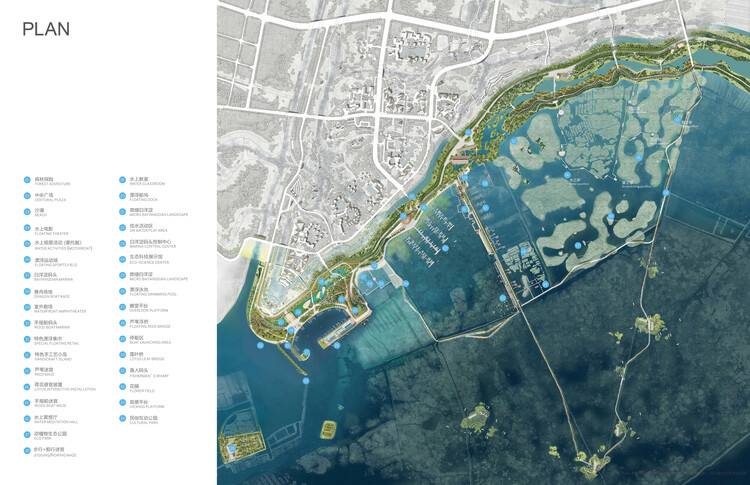
Text description provided by the architects. The design of the Baiyangdian Waterfront Park is inspired by the original landscape pattern of ‘Lotus Pond-Reed Sea’, to interpret the past and to solve modern flooding and ecological problems with a series of eco-levees and a new public marina.’
Northern China is home to many vast shallow lakes; Baiyangdian, the site of the new city of Xiong’an is the largest one. A regional watershed with nine rivers feeds the lake which despite its size reaches a depth of only 3 meters at the center. The lake has always been fragile and is highly susceptible to agricultural pollution from surrounding farms and cycles of flood and drought now intensified by climate change. Normally the outputs of a new city of a million people would only make matters dramatically worse, but this project does the opposite.
Through a regional effort, the inputs from the watershed have been cleaned up and a complex series of planted levees of varying scales and locks regulates water levels. The runoff of the new city is extensively managed and recycled within its own systems before depositing only clean, fresh water into the lake. This new hydrologic stability now allows the lake to begin to clean its waters and sediment once more through the lush native reeds and lotus. This renews its importance as a major stop on the Asian Flyway and the lake and surrounding forests are home to tremendous and highly diverse species of birds as well as aquatic mammals and fish – the lake is again bursting with life.
The lake has a long cultural history and has been a source of community well-being through the harvests of fish, reeds, and lotus roots. People love boating within the maze of channels through the reeds and open water which has led to the construction of a new marina to serve the community’s desire for natural experiences and peaceful recreation. They love hiking, running, and cycling along the network of levees and embankments some of which extend far into the reeds and water. In this way, the recovered lake can become the key ecological amenity and open space of a new city without being destroyed by urbanization but in fact, improved and renewed by it.
The new Baiyangdian Waterfront Park was recently opened to the public including a series of reed-roofed pavilions full of exhibits and historical demonstrations. The surrounding landscape is a composition of ponds and bridges displaying the ecological dynamics and principal species to be found during one’s afternoon boat excursion. The eco-levee and marina project is the first open space / natural system project for Xiong’an, a powerful demonstration of new ecological priorities and the first principles of the new city.
Note: The Xiong-an urban design competition was won in 2018 by the team of SOM and TLS in partnership. Starting in 2019, TLS participated in designing the Baiyangdian Waterfront Area.
Backyard landscape design suggestions are a wonderful way to insert elegance and function to your out of doors place. Whether you’re searching for inventive strategies to make improvements to the aesthetic characteristics of your yard, or you want practical solutions for dealing with complicated-to-handle landscaping things, there’s a whole lot that you can master from these yard landscape style and design ideas. In this article are some of the most resourceful and eye-catching style concepts for your backyard landscape.
1. Insert a water attribute to your backyard
H2o characteristics are a good way to add visual interest and enrich the all round appearance of your lawn. H2o features range in complexity, but they can be as uncomplicated as adding a fountain to a small corner room or as advanced as setting up an elaborate pond with a waterfall display. In addition, incorporating bridges or stepping stones can develop tranquil pathways although also adding functionality. If you want to take your yard landscape layout concepts to the next level, take into consideration putting in tropical crops and bouquets close to your h2o aspect. It is critical to find crops and flowers that are ideal for your local climate, but lots of tropical varieties thrive in extra temperate climates.
2. Use lighting to enrich your backyard landscape
When it comes to out of doors lights, there are a variety of distinct alternatives that can add magnificence and functionality to your backyard area. Lighting can be employed to spotlight backyard capabilities, accentuate drinking water characteristics, or basically include a touch of ambiance and tranquility to your garden. Attractive lamps and string lights are great selections for improving a a lot more standard landscape design and style aesthetic, although photo voltaic-driven spotlights are an effective way to illuminate larger sized regions with minimal headache. Although there are a quantity of diverse lights choices that you can use to enrich your yard landscape, the critical is to pick fixtures that match the style and aesthetic.
3. Generate privacy with crops and hedges
One particular of the largest difficulties that several home owners confront is keeping their privacy in their backyards. No matter whether you have neighbors or prevalent roadways nearby, there are several strategies to generate a personal residing place inside of your landscaping style and design elements. Lively bouquets are a single option for including colour and texture without the need of obstructing views, even though tall trees offer shade as nicely as a visual barrier. You can also incorporate hedges and shrubbery as a means of creating privacy with no obstructing sights. This can be particularly valuable for property owners who want to maintain privacy with no obstructing the views of their neighbors.
4. Include seating for entertaining friends
No matter if you want to host backyard barbecues, garden functions, or basic get-togethers with pals and loved ones, obtaining sufficient seating options is critical for any thriving outdoor accumulating. Whether or not it is including cushions to your current patio furniture established or putting in comfortable benches along the perimeter of your garden, there are a lot of resourceful ways to incorporate this aspect into your backyard landscape design options. It is also essential to integrate lighting solutions, these types of as candles or string lights, to enable continue to keep your friends relaxed throughout evening gatherings.
5. Give your yard an up-to-date glance by introducing color and texture
The most straightforward way to develop a stunning residing room within just your yard budget is by picking out plants that insert coloration and texture to the landscape structure. Irrespective of whether you are on the lookout to fill in uncomfortable areas with vibrant flowers and shrubs, or you want to set up lush green lawns, there are a lot of possibilities for including colour and comfort and ease to your yard. In addition to vegetation, stone pavers and pebbles can also be used as an affordable way of introducing shade, texture, and visual fascination though decreasing servicing burdens.
6. Tailor your design aspects primarily based on your precise wants
It’s essential to diligently contemplate your possess desires when it comes to backyard landscape layout thoughts. This suggests having into account factors this sort of as the measurement of your outdoor place, desired capabilities (like ponds or fountains), present buildings (this sort of as patios or fences), and local weather, among others. By customizing your design components to healthy your wants, you can build a yard that is purposeful and enjoyable for a long time to come! Also, if you are doubtful about how to start out making your ideal backyard, take into consideration consulting with a expert landscaping service for skilled information and style programs. In general, there are several different approaches to produce a stunning and practical backyard landscape design and style.
Developing a lovely and practical yard landscape design can be a enjoyment and gratifying process. By incorporating plants, seating spots, lighting, and other essential factors into your structure programs, you can create the perfect space for relaxing, entertaining company, or simply taking pleasure in the outdoors. Moreover, it is significant to tailor your design factors based on your distinct desires and tastes, as well as get into account components these types of as weather, dimension of your garden, present constructions, and other critical criteria.
The adhering to editorial from Thomas Woltz improvements the obligation of landscape architects to make a cleaner, greener, and extra equitable upcoming as city populations swell and the impacts of local weather alter set current defenses to the take a look at. This alliance with infrastructure serves as a fitting direct-off for the Concentration segment of the Oct/November version of The Architect’s Newspaper themed on landscape. Alongside with a review of Kevin Loughran’s Parks for Income: Marketing Character in the Metropolis and a cloth-focused Pictorial, this portion showcases a quartet of town-bound projects—three in the San Francisco Bay Place and just one in the heart of Manhattan—that, though diverse in scale and scope, deliver resiliency, biodiversity, and natural beauty to the forefront. Continue to keep an eye out for these items in the coming days. —The Editors
The upcoming want for infrastructural investment in the United States is an amazing opportunity for the community of landscape practitioners. There is strong possible in the alignment of infrastructural wants with the design and style community’s equipment to creatively tackle some of the most pernicious challenges dealing with our modern society nowadays, like an interrelated set of social, cultural, and environmental crises. The speedy drop in biodiversity, raise in climate extremes, and social disenfranchisement of minority communities, coupled with failing infrastructure, are urgent difficulties that need to be front of intellect in reimagining the essential networks of our globe and our nation. The best options will be observed inside of innovative collaborations throughout disciplines that align the engineered, ecological, cultural, and social.
In modern a long time, landscape architects have delivered compelling projects that punch earlier mentioned the usual response of engineered methods by employing multidisciplinary design and style approaches with multivalent objectives. Relatively than merely capping an interstate, OJB established a thriving general public landscape in a dense urban area of Dallas. Discipline Operations’ Tunnel Tops tasks in San Francisco’s Presidio, which opened this yr, produce a considerable backlink amongst the Drill Area of the Presidio and Crissy Discipline Park by Hargreaves Associates together the shore, made in 1990. These initiatives reimagine transportation infrastructure to supply generous city ordeals that persuade new kinds of neighborhood, collecting, and celebration.
Far too normally parks are viewed as empty land, “green area,” a tabula rasa, ripe for growth alternatively than identified as necessary contributors to city daily life. Memorial Park, Houston’s most significant park, consists of 1,500 acres of forest, river, and prairie, a lot of which was once inaccessible to the public, owing to just about a century of neglect and deficiency of investment decision. Throughout Globe War I, the site was Camp Logan, a schooling floor for soldiers planning for struggle. (The race relations of the period heightened tensions involving Black soldiers and white community law enforcement officers, culminating in a riot in 1917.) At the close of the war, a distinguished Houston loved ones suggested that the camp become a community landscape, envisioning it as a memorial to the troopers who educated there. With no a strategy, having said that, it was treated as a wilderness park, untended, with athletic facilities scattered haphazardly across its expanse. In the 1950s, an sick-conceived infrastructure challenge split the inadequately tended park in two when 6 lanes of roadway ended up designed.
Memorial Park internet site strategy (Courtesy Nelson Byrd Woltz)
In 2012, following four yrs of intense drought, the park confronted a different devastating blow: Up to 80 p.c of the forest canopy died, supplying the wake-up simply call the town essential to rebuild its greatest community landscape. Nelson Byrd Woltz Landscape Architects was employed in 2013—and after two years of local community input and design and style perform, the firm introduced a thorough eyesight for the subsequent 20 years of improving the park’s existing assets building new public places and addressing main infrastructural requires of parking, water high-quality, stormwater management, resiliency, biodiversity, and connectivity.
A collaborative style tactic in an city landscape of 1,500 acres can tackle environmental infrastructure at scale and in layered and effective ways. Aims for Memorial Park incorporated cleansing stormwater, storing water for irrigation, mitigating flood destruction, restoring biodiverse indigenous prairie and forest communities, re-establishing wildlife connectivity, and lessening the heat island influence. Of equivalent significance, but most likely fewer obvious, is the stewardship of cultural landscape methods together with the ecological assets, revealing the stories of the peoples who have occupied and applied this land over hundreds of years. From the Karankawa men and women, Spanish settlers, and westward expansion to Entire world War I and the fashionable day, the layout of just about every challenge inside the park entwines ecological and cultural revelation with the human working experience of the landscape.
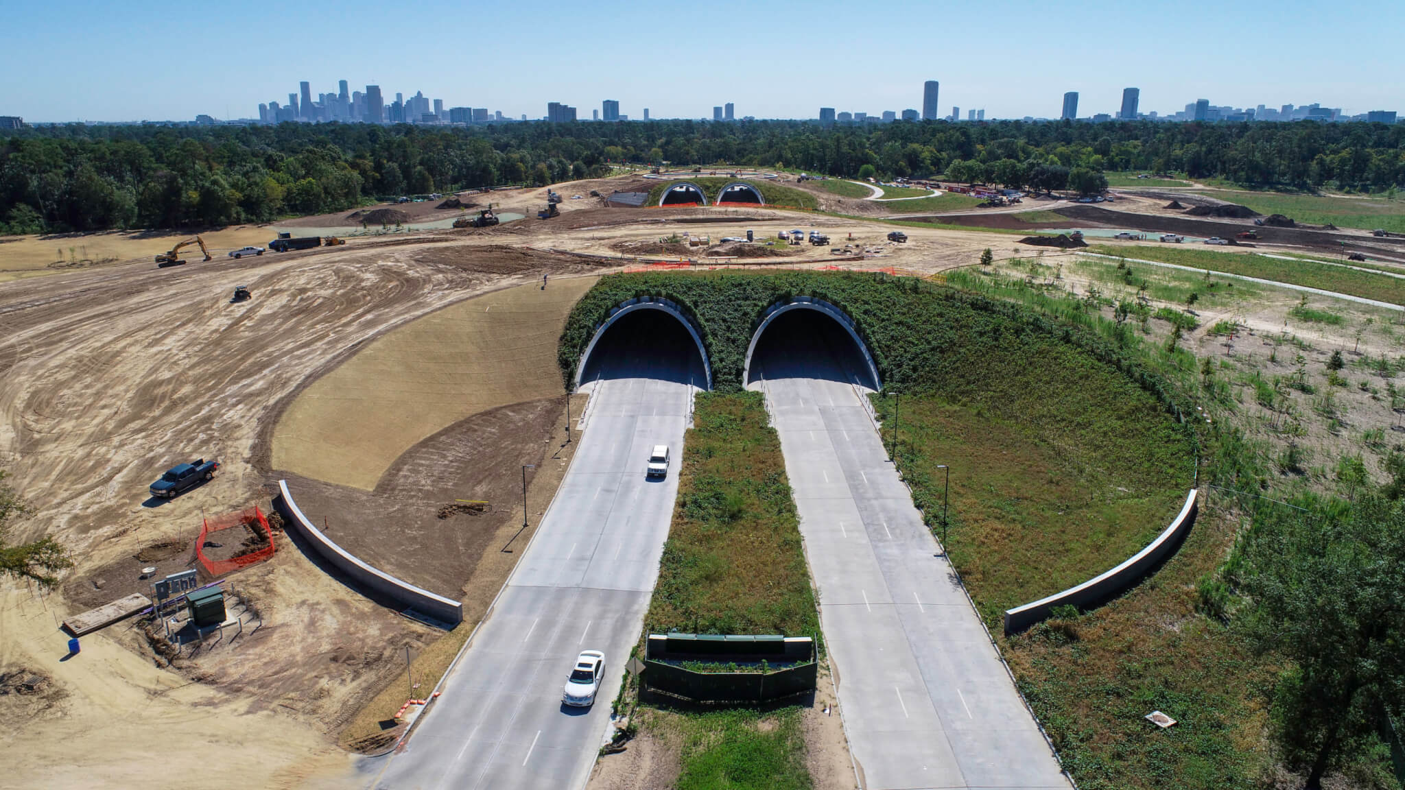
Land Bridge less than development at Memorial Park in Houston. (Courtesy Nelson Byrd Woltz)
Opened to the general public in 2021, the Eastern Glades, a 100-acre portion of the park, incorporate sustainable parking style, stormwater mitigation, wetland conservation, and forest restoration with new amenities for park end users. A recently made five-and-a-half-acre lake captures and treats stormwater and in the approach offsets thousands and thousands of gallons of potable water to deal with the irrigation requires for significant regions of the park. Architectural interventions of gates, piers, pavilions, and terraces provide clues that acknowledge the armed service record of the internet site, and substantial trails have interaction guests in the assorted restored ecosystems and cultural landscapes. These new amenities display the prosperous integration of sustainable initiatives without renouncing the thing to consider of the human practical experience in huge-scale infrastructure.
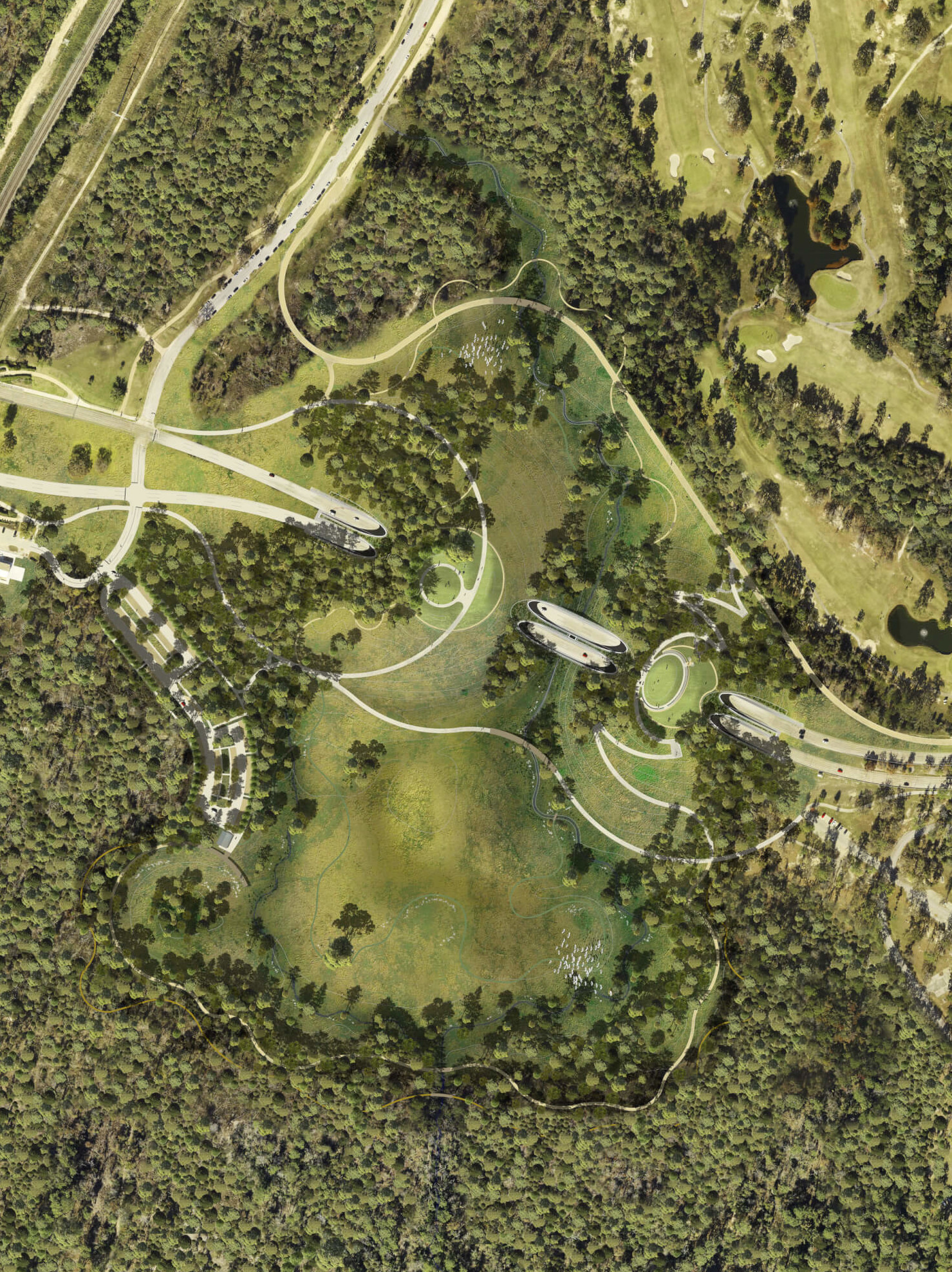
Potentially the most bold challenge from the comprehensive system for Memorial Park is the really intricate 100-acre Land Bridge and Prairie Challenge, which will open to the general public in December. This infrastructure task builds on the precedents of Dallas’s Klyde Warren Park and the Presidio Tunnel Tops to supply a multilayered landscape of eco-friendly infrastructure, stormwater management, and human and wildlife connectivity. 4 tunnels designed of large-general performance concrete shells accommodate targeted traffic when supporting two earthen plateaus, climbing to about 35 ft higher than grade, that give sweeping sights of the Houston downtown and uptown skylines. On the Western Mound, interventions at floor amount reveal information about the surrounding indigenous ecosystems as they carry people to these vantage factors, and at the major, just about 1,000 linear toes of benches foster impromptu general public overall performance and interaction, whilst designed elements expose photo voltaic alignments in the course of the equinoxes and solstices.
Ecologically, the undertaking establishes 9 acres of indigenous savanna and 45 acres of Gulf Coast prairie that filter stormwater right before slowly but surely releasing it into Buffalo Bayou. Beneath the route of the Memorial Park Conservancy, indigenous seeds from area prairie fragments were being gathered and cultivated in excess of the previous four yrs to be utilized in the task, creating this an amazing precedent of urban prairie restoration. Through this infrastructure undertaking, the human practical experience is enriched by way of very carefully offered facts about the record and ecology of the web site, as a result of newfound vistas across the land, and by way of meaningful immersive encounters in indigenous Texan ecologies.
The potential for this degree of beneficial affect on biodiversity and the human expertise lies latent in just about every important infrastructure engineering challenge of the day. It is paramount that the landscape and architecture layout communities direct the way in rethinking our urban methods. The tools of layout are potent. If they are wisely utilized, we can set the “public” again into “public is effective.”