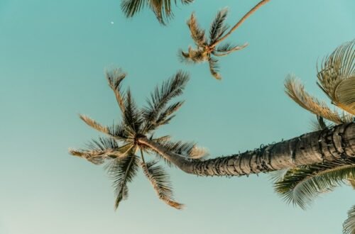
Touring Sedona: Cathedral Rock, Devil’s Bridge, Pink Jeeps, vortexes and more
SEDONA, Arizona – The sky was cerulean blue, the rock sienna red.
My face was pretty red too, having just climbed 700 feet nearly straight up.
But my, oh my, what a view.
This particular view was atop Cathedral Rock, a stunning sandstone formation filled with spires and towers just south of Sedona. But there were views just like this all around – atop Chicken Point, Submarine Rock and Devil’s Bridge, among other locations. And those are just the ones I had time for, during a too-quick, two-day visit last month.
There’s a reason that tourism to Sedona has exploded in recent years. The place is drop-dead gorgeous.
The best views are on two feet, on any of the more than 400 miles of hiking trails that snake their way through red rock country. But even nonhikers will find much to marvel here, along the winding roads, at scenic overlooks – even from the downtown shops and restaurants.
During a quick lunch on our second day in town, I commented to my husband, “Even the fast-food restaurants come with amazing views.”
Among our activities: We took a Pink Jeep Tour through the park, drove along spectacular Oak Creek Canyon Scenic Drive, took a peek inside the gorgeous Chapel of the Holy Cross and saw a stunning sunset atop Airport Mesa.
The best, though, was the hiking, to and through some Seussian rock formations.
The town of Sedona, population 10,000, is surrounded by public land, although this is not a national park. Rather, most of the region is part of Coconino National Forest, a division of the U.S. Department of Agriculture, which stretches across nearly 2 million acres north of Flagstaff to south of Sedona.
Tourism to the region has tripled in recent years, which can make the roadways and parking areas extremely congested, although the crowds weren’t bad during my visit in early March.
In addition to its tremendous appeal among outdoor enthusiasts, Sedona has also become a mecca for the New Age movement, drawing visitors who seek what they believe is powerful and healing energy emanating from the red rocks.
Randy Michael, a long-time guide with Pink Jeep Tours, is a New Age skeptic, but he does believe in the power of the region’s beauty. “I feel Sedona is a healing place. That’s an honest answer,” he said in response to a question about Sedona’s metaphysical side.
Indeed, the physical side here was plenty enough for me. Here then, how I spent two days in Sedona:

The view from atop Cathedral Rock, part of Coconino National Forest in Sedona, Arizona.

Chapel of the Holy Cross was built into the Sedona red rocks in the mid-1950s.

A couple in matching jackets pose atop Devil’s Bridge in Sedona, Arizona.
Exploring on two feet
We drove north about two hours from Phoenix and went immediately to our first hike, a gorgeous, moderate trail that took us to Chicken Point, a massive, rounded rock that offers terrific, 360-degree views of the surrounding landscape, but which also functions as a bit of a wind tunnel — so hold onto your hat.
The red rocks of Sedona are made of something called Schnebly Hill Sandstone, named after the founder of the town, Carlton Schnebly. They get their color from the abundance of iron in their composition.
This is a popular spot for not only hikers, but off-road 4×4 vehicles and mountain bikers, who were scaling and descending the sandstone as we arrived. We witnessed one biker wipe out as he lost control on his descent. Ouch.
After our hike, we took a peek inside the stunning Chapel of the Holy Cross, built into the sandstone in 1954, conceived by artist Marguerite Brunswig Staude, a former student of architect Frank Lloyd Wright.
It was mid-afternoon at this point – enough time for one more trail. So we headed to the Cathedral Rock area, which is often listed as the most popular hike in the region.
Parking here, and everywhere in Sedona, can be a challenge. Indeed, a traffic officer was restricting cars onto Back O’Beyond Road as we arrived, but motioned us through, as a single spot had just opened up.
There are a few different ways to reach Cathedral Rock, a rock formation that is one of the most photographed areas of the park. We chose the most direct – via a short, strenuous trail that pretty much maneuvers straight up the rockface. I was on all fours for part of it, both going up and coming down, trying to lower my center of gravity to prevent slipping.
But what a payoff.
A couple was getting engaged when we arrived at the top. Another group was celebrating with a picnic (how they carried the food up, I have no idea). I sat for a while, resting and marveling at Mother Nature’s handiwork.

Rock scrambling to the top of Cathedral Rock.

A view of Chicken Point from below, along the Little Horse Trail in Coconino National Forest in Sedona.

A mountain biker en route to Devil’s Bridge in Sedona, Arizona.
Our third hike, the next morning, was to Devil’s Bridge, also one of the most popular hikes in the area. (“Don’t let its name fool you,” says a Forest Service description. “It’s one of the most heavenly sights in an area famous for them.”)
We got there early, at about 8 a.m. – after a carb stop at Sedonuts – to discover the parking lot was under construction and closed. We parked along the side of the road, which was already lined with cars. As we hiked in, we encountered people on their way out – they had been here for sunrise, which was a bit too ambitious for me.
The payoff on this hike is a 54-foot-high natural bridge, a beautiful formation amid a vast landscape of beautiful formations.
In the Instagram age, it’s become very popular to have your photo taken posing atop the bridge. By the time we got there, the line to walk out on the arch was an estimated hour wait. I decided to forego the photo.
“It’s not because I’m afraid to walk across it,” I told my husband, although I’m not sure he believed me.

A Sedona sunset, as seen from Airport Mesa.

The line to have your photo taken atop Devil’s Bridge in Sedona.

View from the front seat of a Pink Jeep Tour.
Exploring on four wheels
After our Devil’s Bridge hike, we gave our feet a rest, hopped in the car and headed north along Oak Creek Canyon Scenic Drive, aka Arizona Route 89A, which meanders 27 eye-popping miles to Flagstaff. The drive offers towering cliffs on either side, crystal clear Oak Creek at its base and hairpin turns along the way. We turned around at the halfway point, Oak Creek Canyon Vista Point, after climbing about 1,000 feet via a series of dramatic switchbacks.
It was blowing and snowing at the top, so we cut short our viewing time, briefly perused the market of Native American vendors selling jewelry and artwork, then headed back south to Sedona, where we were booked on a 3 p.m. Pink Jeep Tour.
There are numerous 4×4 tours in the area, but Pink Jeep started it all in 1960, when real estate agent Don Pratt took clients to see property in his World War II surplus vehicle. “Before he knew it, he was taking people for Jeep rides,” said guide Randy Michael. He bought another vehicle and another.
A trip to the pink Royal Hawaiian Hotel in Honolulu gave Pratt and his wife, Elsie, another idea. “They saw the brilliance in the marketing of that color,” said Michael. “They came back and painted all of their Jeeps pink.” In the decades since, the company has expanded to the Smoky Mountains, Grand Canyon, Las Vegas and, new this year, Branson, Missouri.
Pink Jeep and other companies offer a variety of tours – from mild to wild, exploring both the geologic and human history of the region.
We opted for the Broken Arrow tour – “a slow motion roller coaster ride,” according to Michael – which follows an old ranch road through the landscape. It was great fun, traversing up, down and over giant rocks.
Michael provided excellent, entertaining commentary along the way, informing us about the region’s prolific movie-making history (“they used to call us Little Hollywood”) and the meaning of the name Sedona. It was town founder Carlton Schnedley’s wife’s first name. “It has no meaning,” said Michael. “It is not a Native American term. It is made up.”
He also provided a local’s perspective on the region’s reputation as a mecca for the New Age movement. He credited its inception to the late Page Bryant, a psychic and author who identified several locations in the area as powerful energy centers, which she called vortexes.
“It’s a brilliant business model – create an idea that no one can prove or disprove. And then sell a lot of books,” said Michael.
The movement changed Sedona, its main streets now lined with shops including Crystal Magic, Psychic Readings and Mystical Bazaar. Most of the tour companies – including Pink Jeep – offer vortex tours, which take riders to some of the most powerful energy centers.
“I take them to the sites and let them feel what they feel,” said Michael. “If you come here looking for it, I think it’s likely you’ll find it.”
I spent two nights at Sky Ranch Lodge, located atop Airport Mesa, reportedly one of the region’s most powerful vortexes. I didn’t get a metaphysical charge from the place, although I did appreciate the hot tub after a day of hiking.
Cathedral Rock, too, is another one of the region’s major energy sources. I can’t say that the hike to the top of the rock gave me great energy – if anything, it depleted me of some, as I ran out of water in my struggle to reach the top.
But wow, oh wow, what a view.

Winter weather at Oak Creek Canyon Vista Point, along Arizona 89A just north of Sedona.

Cathedral Rock, one of the Sedona region’s most popular hiking destinations.

Rock scrambling at Cathedral Rock.

“A slow motion roller coaster ride” on a Pink Jeep Tour in Sedona, Arizona.
If you go: Sedona, Arizona
When: Thanks to its 4,350-foot elevation, the climate in Sedona is more varied than in Phoenix, about 120 miles south. It does snow here in the winter, when overnight lows dip into the 30s. Summer highs frequently hit the 90s, making spring and fall the peak seasons to visit.
Getting there: Most visitors fly into Phoenix, although Flagstaff Airport is closer and served by United and American airlines. Visitors frequently pair a trip to Sedona with the Grand Canyon, two hours north.
Where we stayed: There are lots of places to overnight in Sedona, almost all of them pricey. We opted for two nights at the Sky Ranch Lodge, located on Airport Mesa, centrally located between Uptown Sedona and West Sedona, the two commercial districts in town. It’s a beautiful property, with views of the red rocks a short walk from our room. We paid roughly $350 per night.
Where to eat: Our first night in town, we ate steak and prickly pear cactus fries at the Cowboy Club Grille, a long-time Sedona classic, where John Wayne, Jimmy Stewart and other Hollywood stars dined decades ago, when it was the Oak Creek Tavern. On the second night, we walked to Mesa Grill Sedona, atop Airport Mesa, for Southwestern fare and beautiful views. Also: Wildflower for lunch and Sedonuts for breakfast.
Pink Jeep Tour: We paid $137 each for the two-hour Broken Arrow tour; pricey, but worth it.
Hike parking: Some national forest parking areas require a parking pass; we picked one up upon arrival — $15 for a week or $5 per day.
More information: visitsedona.com, fs.usda.gov/coconino
More Arizona:
Two days in Tucson: Hiking, biking, saguaros and Sonoran hot dogs
No spring training in Phoenix? Try the Musical Instrument Museum, Frank Lloyd Wright, Dale Chihuly and more
Waiting for Thrifty: Rental car woes expected to continue, with long lines for cars and high daily rates

Mountain biking near Cathedral Rock in Sedona.

View of the red rocks from the outdoor patio at Wildflower.

On the trail to Chicken Point.
You May Also Like